auto-boundary
Automatically set a boundary using camera shot locations to limit the area of the reconstruction. This can help remove far away background artifacts (sky, background landscapes, etc.). See also –boundary. Default: False
--auto-boundarynullnullResource |
Impact |
|---|---|
CPU |
●○○ | Low |
GPU |
○○○ | None |
HDD |
○○○ | None |
RAM |
●○○ | Low |
Time |
●○○ | Low |
What Is Auto-Boundary?
--auto-boundary is a process that seeks to limit the boundaries of the reconstruction based upon a K-Means filtered Convex Hull buffered by 20x the mean GSD of the dataset.
When Is Auto-Boundary Helpful?
--auto-boundary is appropriate to use on any dataset where one might possibly consider limiting the area of reconstruction due to the presence of sky or far-away background that they would not normally consider part of the desired reconstruction.
--auto-boundary does not have a meaningful impact on nadir (or near-nadir) imagery without sky/background, making it superfluous, but safe, to include.
In other words, if you would consider masking the image, --auto-boundary is likely a good choice.
Why would one use auto-boundary?
Auto-Boundary is most helpful in preventing the reconstruction area from growing needlessly large when things like sky, clouds, or far-away features like treelines get included in the reconstruction.
By preventing the boundaries of the reconstruction from growing needlessly large, Out-Of-Memory errors become far less likely, and one will likely see a decrease in processing time due to the smaller area being reconstructed.
Example Images
True: --auto-boundary
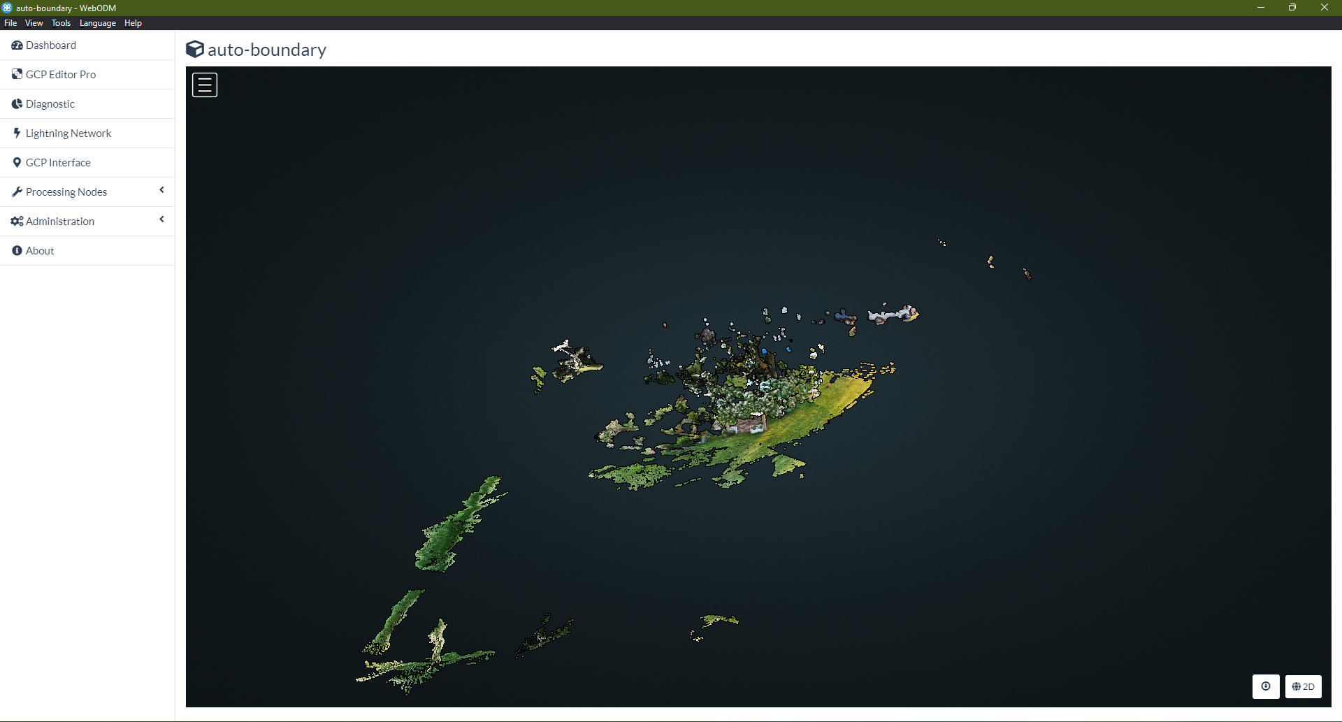
The WebODM 3D View shows the full extent of the reconstruction, bounded by the --auto-boundary option.
False: null
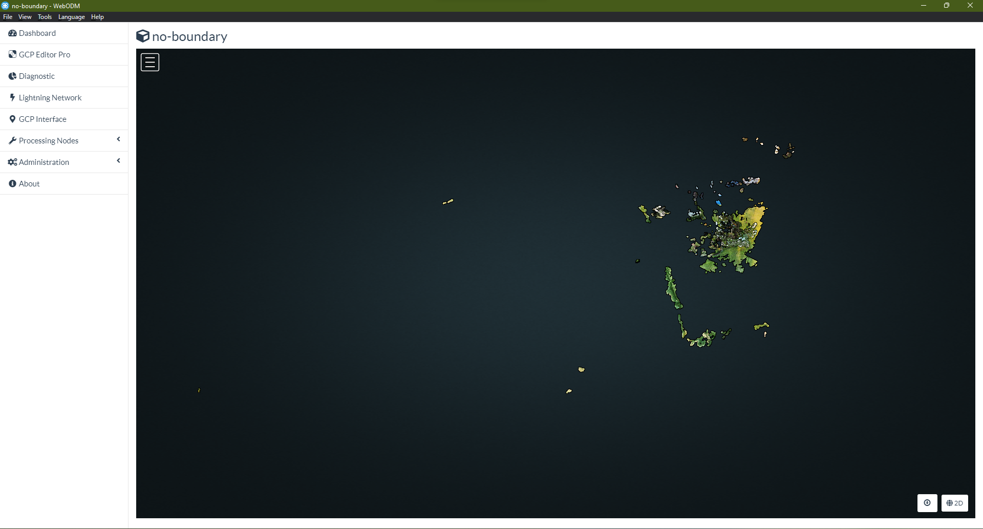
The WebODM 3D View shows the full extent of the recosntruction. Compared to the --auto-boundary reconstruction above, one can see that the full reconstruction area is much larger (and therefore more visually sparse).
Learn to edit and help improve this page!